Flying in virtual reality, a commonly held wish by enthusiasts since the dawn of the technology. The prospect of swooping over virtual landscapes, your mind convinced your body has taken flight is an extremely enticing one. Now that virtual reality technology is becoming a more and more accessible with the advent of the Oculus Rift, attention turns on how best to achieve this experience. There’s one thing you’ll certainly need for that realistic touch, convincing virtual terrain.

aerometrex-oculus-rift1Australian company Aerometrex are working on just that. They are digital aerial mapping specialists who have focussed on providing realistic captures of towns and cities across the real world in order for them to to be realised in the virtual world.

The company flies dedicated UAVs carrying sophisticated cameras across the desired location capturing extremely high resolution and geospatially mapped photos of the area. Combined with 3D depth sensing technologies (collectively known as aero3Dpro), this allows the company to produce astonishingly accurate and lifelike 3D models based on the captured data.

The captured imagery is adjusted, corrected and assembled by sophisticated software to produce a 3D map you can take a very convincing flight over.

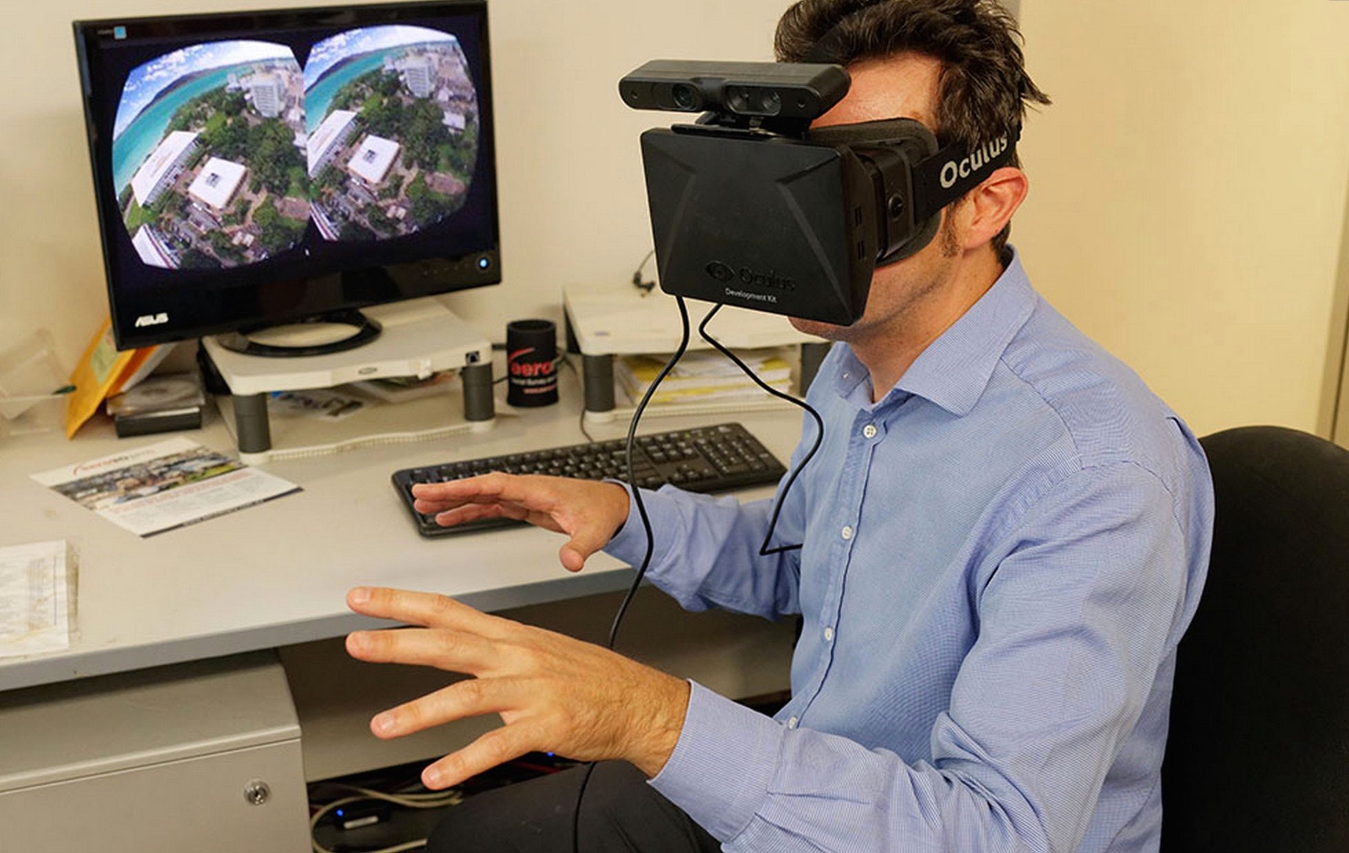
The company recently released a video demonstrating one of their 3D models being presented through the Oculus Rift (video top), and it’s an intriguing idea for presenting and communicating 3D space on such a large scale to people efficiently and effectively. OF course, all I want to do is zoom about pretending to be Superman – something that the video captures quite nicely.

As Aerometrex are focussed on corporate cliental however, it’s currently unclear if they’re ever likely to release tastes of the experiences on offer to the general public. The are apparently working on integrating Myo support, the gesture capturing hardware which senses muscle movement and translates it into input data, which would certainly allow naturalistic flight controls.

SEE ALSO
Apple Releases Impressive Immersive Short of 2023 MLS Playoffs on Vision Pro

You can find more about Aerometrex here, and their dedicated aero3Dpro page here.

Newsletter graphic

This article may contain affiliate links. If you click an affiliate link and buy a product we may receive a small commission which helps support the publication. More information.


Based in the UK, Paul has been immersed in interactive entertainment for the best part of 27 years and has followed advances in gaming with a passionate fervour. His obsession with graphical fidelity over the years has had him branded a ‘graphics whore’ (which he views as the highest compliment) more than once and he holds a particular candle for the dream of the ultimate immersive gaming experience. Having followed and been disappointed by the original VR explosion of the 90s, he then founded RiftVR.com to follow the new and exciting prospect of the rebirth of VR in products like the Oculus Rift. Paul joined forces with Ben to help build the new Road to VR in preparation for what he sees as VR’s coming of age over the next few years.
  • Don Gateley

    This could be the first killer app for the non-gaming segment of the consumer VR market (or the second if Google Street View competently gets there first.) Too bad they seem to have no interest in that.

    • Kemic

      I’m thinking flight sim’s could be made to feel more real. Imagine flying helicopters, jets, or even gliders over realistic looking real world places

      • Don Gateley

        I personally prefer Superman’s view to a cockpit view. :-)

        Imagine looking down to see your Superman costume clad body, out front to see your outstretched arms or behind you to see your cape rippling in the wind.

        I do get what you are saying. For consumer use cockpit flight simulation would definitely be a cool adjunct to presenting the data these guys are getting.

        I hope they are listening.

  • spark

    I believe the work done by Aerometrics looks very similar to the Euclideon Geoverse software.

    Maybe Aerometrics is a mix of its own polygon software with Euclideons polgon conversion and Unlimited Detail software.

    In any case, I think Euclideons Unlimited Detail technology would be very efficient for selecting visible polygons elements out of a complex polygon scene, and those visible polygons could then be rendered conventionally.

    This is the best of both worlds for the time being, and a way to transition Unlimited Detail to existing polygon rendering technology..

    • aero3dpro

      Hi Spark,

      Euclideon Geoverse is a interactive 3D viewer for their own 3D point-cloud format. Aerometrex did provide some 3D model to be converted to their unlimited details format. (check their Burneet highway video on their Youtube channel).
      Aerometrex generate 3D models which can be integrated into multiple 3D engines ( http://aero3dpro.com.au/3D_gis.html).
      The viewer used with the Oculus Rift in this demo is based on a customised OpenScenGraph engine. What you see is a textured 3D mesh with Level of Details and as nothing to do with Euclideon.

      .,

      • spark

        I suppose comparisons with Euclideon Unlimited Detail can be taken as a compliment.

        Your work looks excellent.

        Whilst I do not know what’s possible with your respective technologies, it seems incorporating the Euclideon pixel search algorithm is bound to speed up the the graphics engine.

        Perhaps we need to see what Euclideon eventually does, as they seem to know their technology better than everyone else.

        Thanks for your reply.